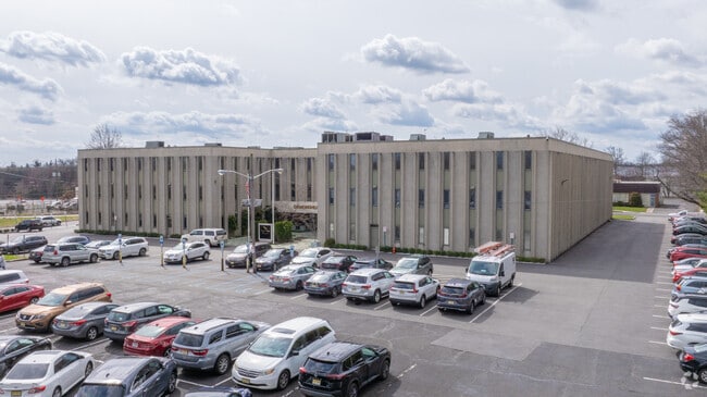
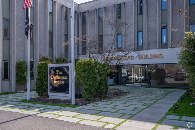
Property Record
200 Sheffield St, Mountainside, NJ 07092

Current Lease Availabilities
NEARBY LISTINGS FOR SALE OR LEASE
Property Detail
200 Sheffield St
10-00007-13-00029
Union
Commercialnec
New Jersey
X
29
34013C0150F
5 AC
2024
Route 22 East
2025
Northern New Jersey
038300
Newark, NJ-PA
103,000 SF
DEMOGRAPHICS near 200 Sheffield St
1 Mile
3 Mile
5 Mile
2024 Total Population
8,157
114,477
339,745
2029 Population
8,125
113,635
337,121
Pop Growth 2024-2029
(0.39%)
(0.74%)
(0.77%)
Average Age
43
41
41
2024 Total Households
2,936
41,310
119,991
HH Growth 2024-2029
(0.54%)
(0.88%)
(0.91%)
Median Household Inc
$156,078
$140,900
$128,876
Avg Household Size
2.70
2.70
2.80
2024 Avg HH Vehicles
2.00
2.00
2.00
Median Home Value
$635,306
$672,338
$575,787
Median Year Built
1967
1955
1955
Nearby Places
Map Layers
Map Styles
 Street
 Aerial
- Restaurants
- Banks
- Shops
- Fitness
- Groceries
PUBLIC TRANSPORTATION
COMMUTER RAIL
Westfield (Raritan Valley Line - NJ Transit Commuter Rail (NJ Transit))
DRIVE
WALK
Distance
Westfield (Raritan Valley Line - NJ Transit Commuter Rail (NJ Transit))
9 min
3.1 mi
Garwood (Raritan Valley Line - NJ Transit Commuter Rail (NJ Transit))
DRIVE
WALK
Distance
Garwood (Raritan Valley Line - NJ Transit Commuter Rail (NJ Transit))
12 min
4.0 mi
AIRPORT
Newark Liberty International
DRIVE
WALK
Distance
Newark Liberty International
21 min
13.7 mi
LaGuardia
DRIVE
WALK
Distance
LaGuardia
55 min
33.0 mi
John F Kennedy International
DRIVE
WALK
Distance
John F Kennedy International
64 min
41.2 mi
Freight Ports
Maher Terminal
DRIVE
WALK
Distance
Maher Terminal
24 min
14.0 mi
Nearby Properties
Address
Land Use
TOTAL SIZE
Lot Size
Zoning
Address
Land Use
TOTAL SIZE
Lot Size
Zoning
Address
Land Use
TOTAL SIZE
Lot Size
Zoning
Address
Land Use
TOTAL SIZE
Lot Size
Zoning
7.19 AC
PI
Address
Land Use
TOTAL SIZE
Lot Size
Zoning
31,905 SF
0.18 AC
Address
Land Use
TOTAL SIZE
Lot Size
Zoning
Address
Land Use
TOTAL SIZE
Lot Size
Zoning
Address
Land Use
TOTAL SIZE
Lot Size
Zoning
0.42 AC
R-1
Address
Land Use
TOTAL SIZE
Lot Size
Zoning
2,806 SF
22.79 AC
Address
Land Use
TOTAL SIZE
Lot Size
Zoning
Address
Land Use
TOTAL SIZE
Lot Size
Zoning
3,538 SF
112 AC
Address
Land Use
TOTAL SIZE
Lot Size
Zoning
144.37 AC
Address
Land Use
TOTAL SIZE
Lot Size
Zoning
117,703 SF
8.29 AC
Address
Land Use
TOTAL SIZE
Lot Size
Zoning
10.82 AC
H
Address
Land Use
TOTAL SIZE
Lot Size
Zoning
9.42 AC
Address
Land Use
TOTAL SIZE
Lot Size
Zoning
17,988 SF
301.08 AC
Address
Land Use
TOTAL SIZE
Lot Size
Zoning
8.32 AC
Address
Land Use
TOTAL SIZE
Lot Size
Zoning
182 SF
13.80 AC
Address
Land Use
TOTAL SIZE
Lot Size
Zoning
17,416 SF
19.42 AC
Address
Land Use
TOTAL SIZE
Lot Size
Zoning
103,773 SF
35.47 AC
Address
Land Use
TOTAL SIZE
Lot Size
Zoning
8.10 AC
Address
Land Use
TOTAL SIZE
Lot Size
Zoning
9.44 AC
Address
Land Use
TOTAL SIZE
Lot Size
Zoning
22,488 SF
7.67 AC
Address
Land Use
TOTAL SIZE
Lot Size
Zoning
19.14 AC
Address
Land Use
TOTAL SIZE
Lot Size
Zoning
Address
Land Use
TOTAL SIZE
Lot Size
Zoning
56,476 SF
141.63 AC
Address
Land Use
TOTAL SIZE
Lot Size
Zoning
4.13 AC
Address
Land Use
TOTAL SIZE
Lot Size
Zoning
12.20 AC
Address
Land Use
TOTAL SIZE
Lot Size
Zoning
4.82 AC
Address
Land Use
TOTAL SIZE
Lot Size
Zoning
Address
Land Use
TOTAL SIZE
Lot Size
Zoning
31,002 SF
3.64 AC
The World's #1 Commercial Real Estate Marketplace
Connect with us
© 2026 CoStar Group
The information above has been obtained from sources believed reliable. While we do not doubt its accuracy we have not verified it and make no guarantee, warranty or representation about it. It is your responsibility to independently confirm its accuracy and completeness. Any projections, opinions, assumptions, or estimates used are for example only and do not represent the current or future performance of the property. The value of this transaction to you depends on tax and other factors which should be evaluated by your tax, financial, and legal advisors. You and your advisors should conduct a careful, independent investigation of the property to determine to your satisfaction the suitability of the property for your needs.